Output: Map (digital + print).
Topics: Critical cartography, environmental justice.
Tools/Skills: ArcGIS online, Adobe Illustrator, Qualitative research.
Topics: Critical cartography, environmental justice.
Tools/Skills: ArcGIS online, Adobe Illustrator, Qualitative research.
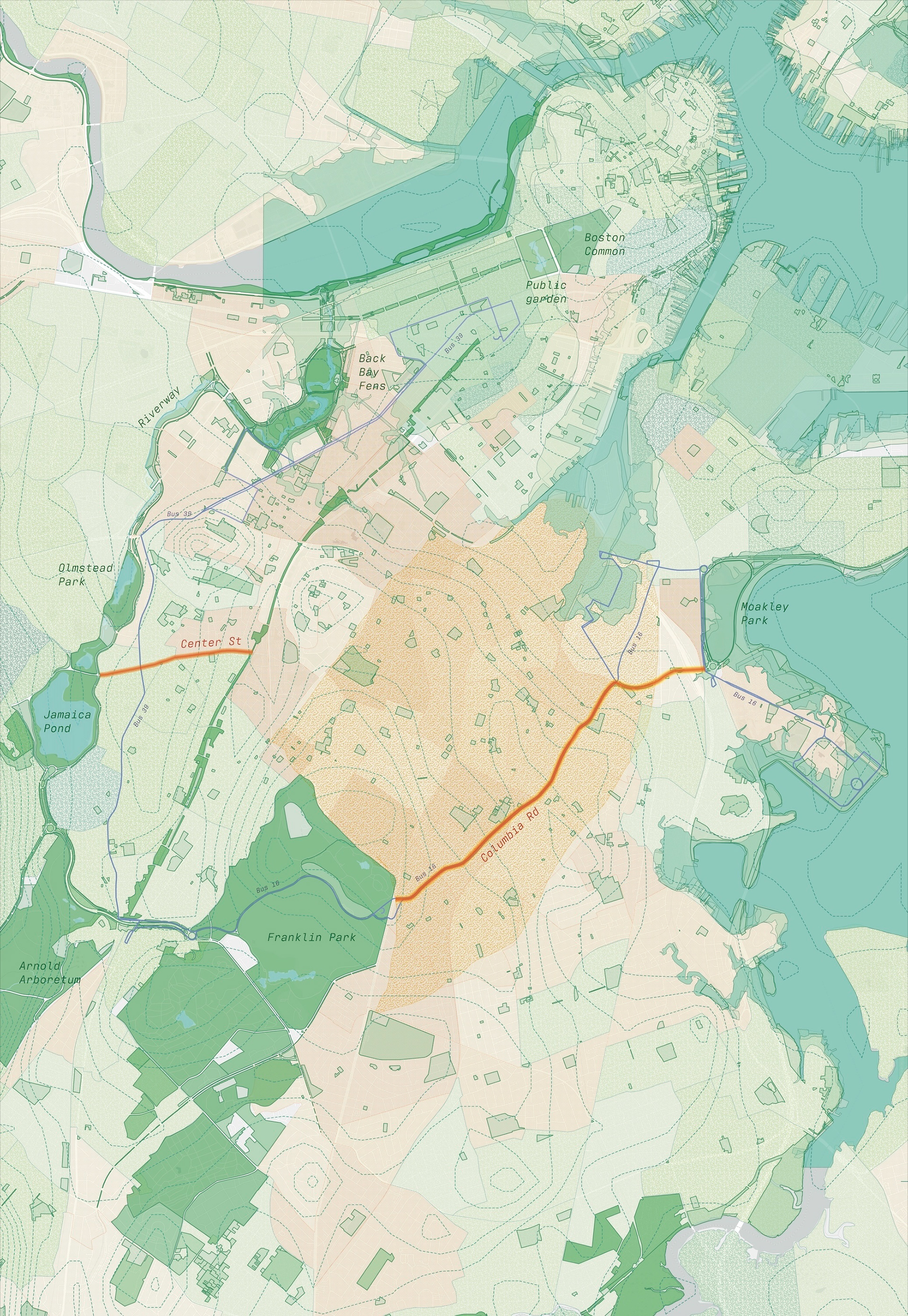
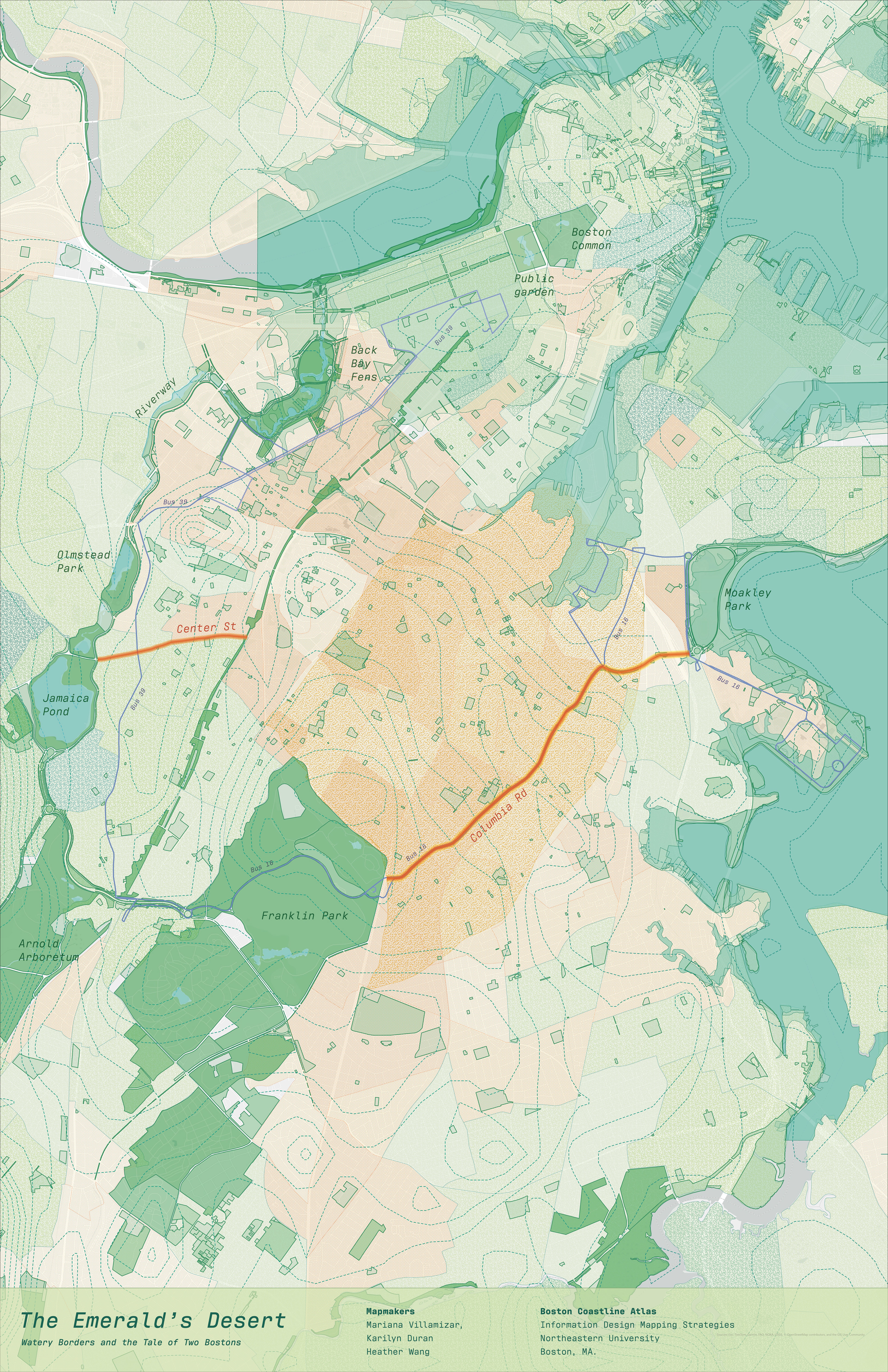
This critical cartography project maps how Boston’s built landscape reinforces exclusion through unequal access to nature. Through a printed map and a research report, our team examined how proximity to natural features like Jamaica Pond shaped neighborhood value, while Dorchester, left out of the city’s landscape network, remains disconnected and underinvested.
Find the high-resolution map at the bottom of the page.
Research Process
The research combined a review of literature on critical cartography, Boston’s Emerald Necklace park system, and the history of Jamaica Pond. We also visited Jamaica Pond and Columbia Road to compare firsthand the differences in access to nature and transportation.
Base Map
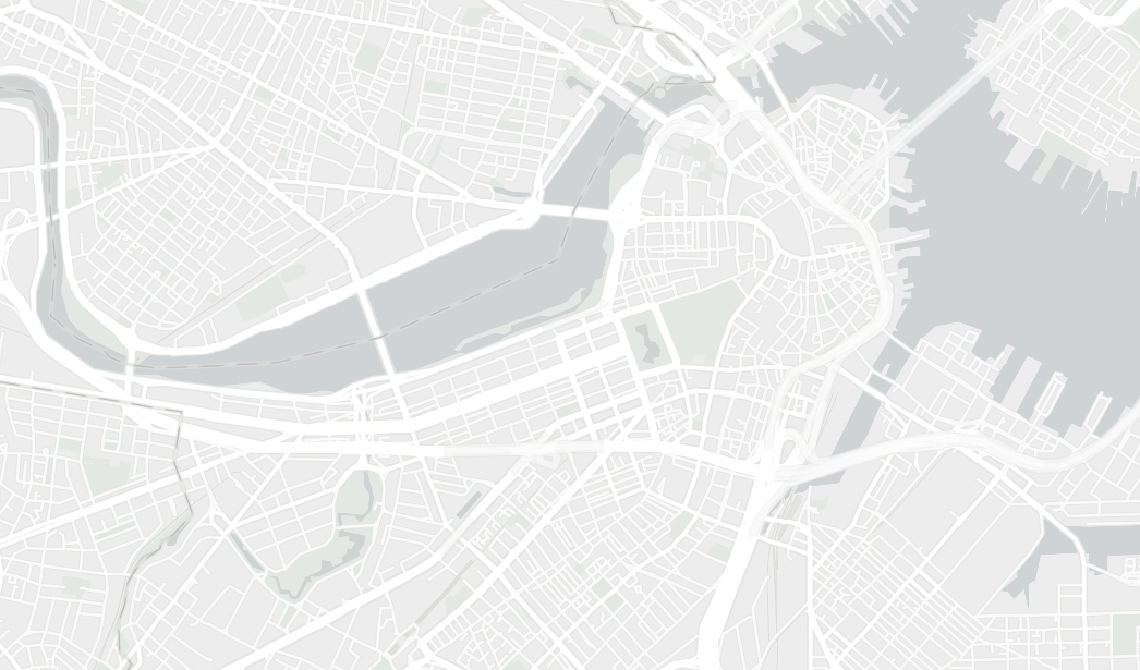
The map was assembled using ArcGIS online. As a basemap, the tool's light gray canvas was chosen for its minimalism, which allowed keeping the focus on the other layers.
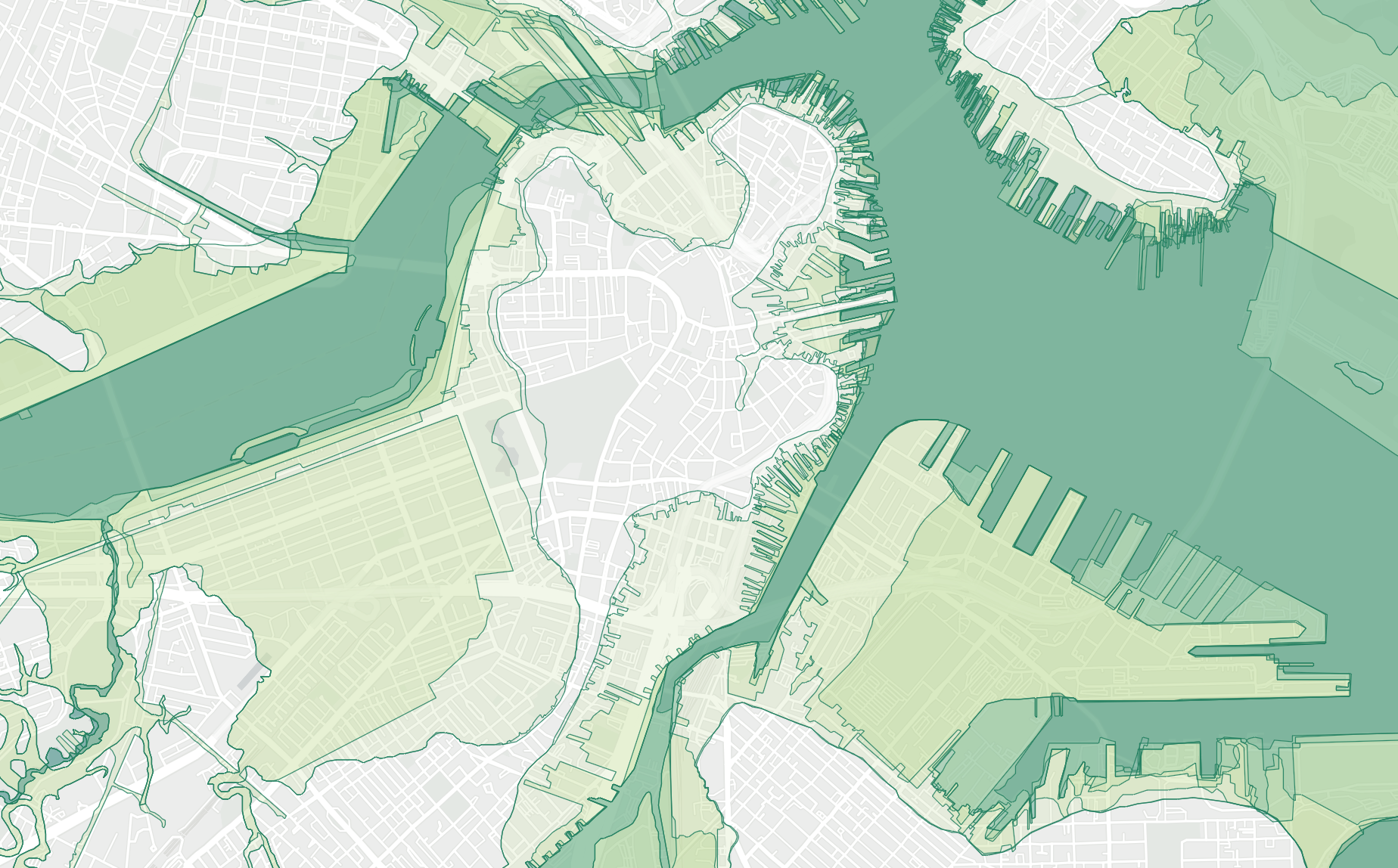
Layer: Boston's Shorelines
A crucial aspect of Boston's natural landscape stems from the expansion of the city towards the ocean. This layer shows shoreline changes from 1630 to today.
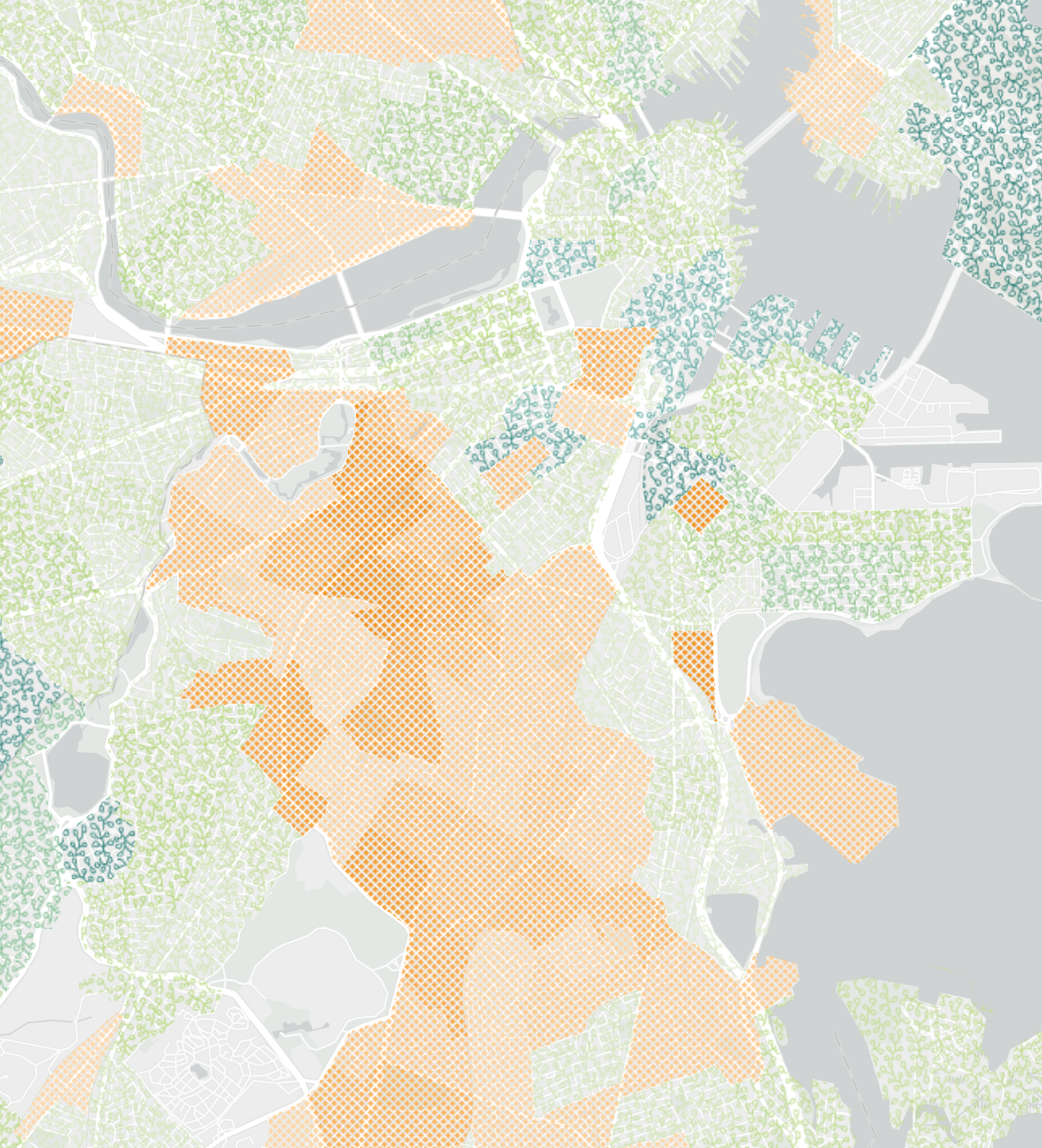
Layer: Median Household Income
To highlight the contrast in access to resources, a layer was included with information on the median household income in past 12 months. The areas with above average income were assigned a green, leafy pattern, while the areas with below average income show an orange, dotted pattern to resemble a desert.
Credits
This project was done in collaboration with Karilyn Duran and Heather Wang for the course Information Design Mapping Strategies with Professor Gökçen Erkiliç.
This project was done in collaboration with Karilyn Duran and Heather Wang for the course Information Design Mapping Strategies with Professor Gökçen Erkiliç.